Hunter Valley Access

Background
The Hunter River flows 42km from the Main Divide of the Southern Alps into the head of Lake Hāwea. While the river’s headwaters are part of Hāwea Conservation Park, the lower reaches are on leasehold land, part of Hunter Valley Station, managed by the Cochrane family and owned by US broadcaster Matt Lauer.
Public Access
In a press release on 28 September 2018 DOC announced the signature of an agreement with Orange Lakes (NZ) Ltd, describing public access through Hunter Valley Station.
The agreement sets clear rules for public access by walkers, mountain bikers, horse riders and 4WD vehicles. Access is available by permission only, and must be arranged with Orange Lakes at least one day prior to arrival to the station. The preferred method of contact is via e-mail on hvfarmingco@gmail.com; alternatively you can ring 03 442 1242. Parties wishing to obtain access are urged to read the whole agreement document, and will need to sign a form prior to entering station land.
There will be no access during lambing (1 October to 1 December) and no access to 4WD vehicles during the winter months (1 May to 30 November). Access may also be restricted during farming operations.
Please post the nature and the outcome of your inquiries on the Hunter Valley Access facebook page.
How to get to the Hunter Valley:

Hunter Valley access map. Meads Road as far as Terrace Creek (public access) in purple. Click on the map to download as a .pdf
From Wanaka, drive SH6 towards Haast Pass as far as The Neck between Lake Hāwea and Lake Wanaka, the turn off onto the unpaved Meads Road. This is a public road as far as Terrace Creek, beyond which point permission for access is required from the Cochrane family (see contact details above).

Hunter Valley map. The 4WD track crosses private land below Scrubby Flat Creek. Click on the map to download as a .pdf
Recreation in the Hunter Valley and Hāwea Conservation Park
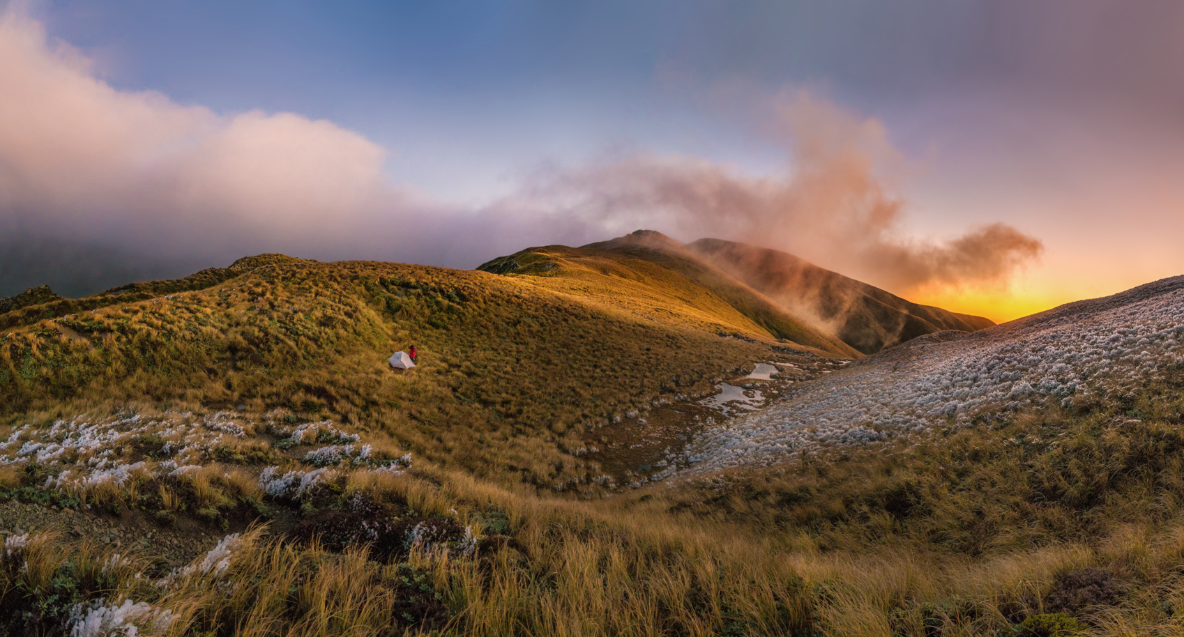
The upper Hunter is a tramping paradise, supported by a number of public huts (Bull Flat Hut, Ferguson Hut, Forbes Hut). It offers several side trips into picturesque tributaries, and alpine crossings into the adjacent Ahuriri, Makarora, Huxley and Landsborough Rivers.

The Hunter from the saddle with Little Canyon Creek. Photo D Hegg.
View into the Hunter River and Lake Hawea from Tent Peak. Photo D Hegg
The mountains surrounding the Hunter River offer excellent mountaineering trips in a remote setting, as well as ski-touring opportunities in winter and spring. Noteworthy peaks that can be accessed from the Hunter include Mt Heim, Mt Barth, Mt Calvin, Mt Huxley, Mt Strauchon, Mt Maitland, Mt Enderby, Mt Brewster, Tent Peak to name just a few.

On the summit of Mt Napoleon. Square Top, Wills Peak, Mount Maitland and Mount Pearson in the background. Photo D Hegg.
The flat valley floor is suited to mountain biking and pack-rafting.
Like most tributaries of Lake Hawea, the Hunter River offers excellent trout fishing, whereas the surrounding valley floor and mountains abound with opportunities to hunt red deer, chamois and tahr.
Share This Story, Choose Your Platform!

Latest News
Submit on the National Conservation Policy Statement, which will shape how our public conservation land is managed for years to come.
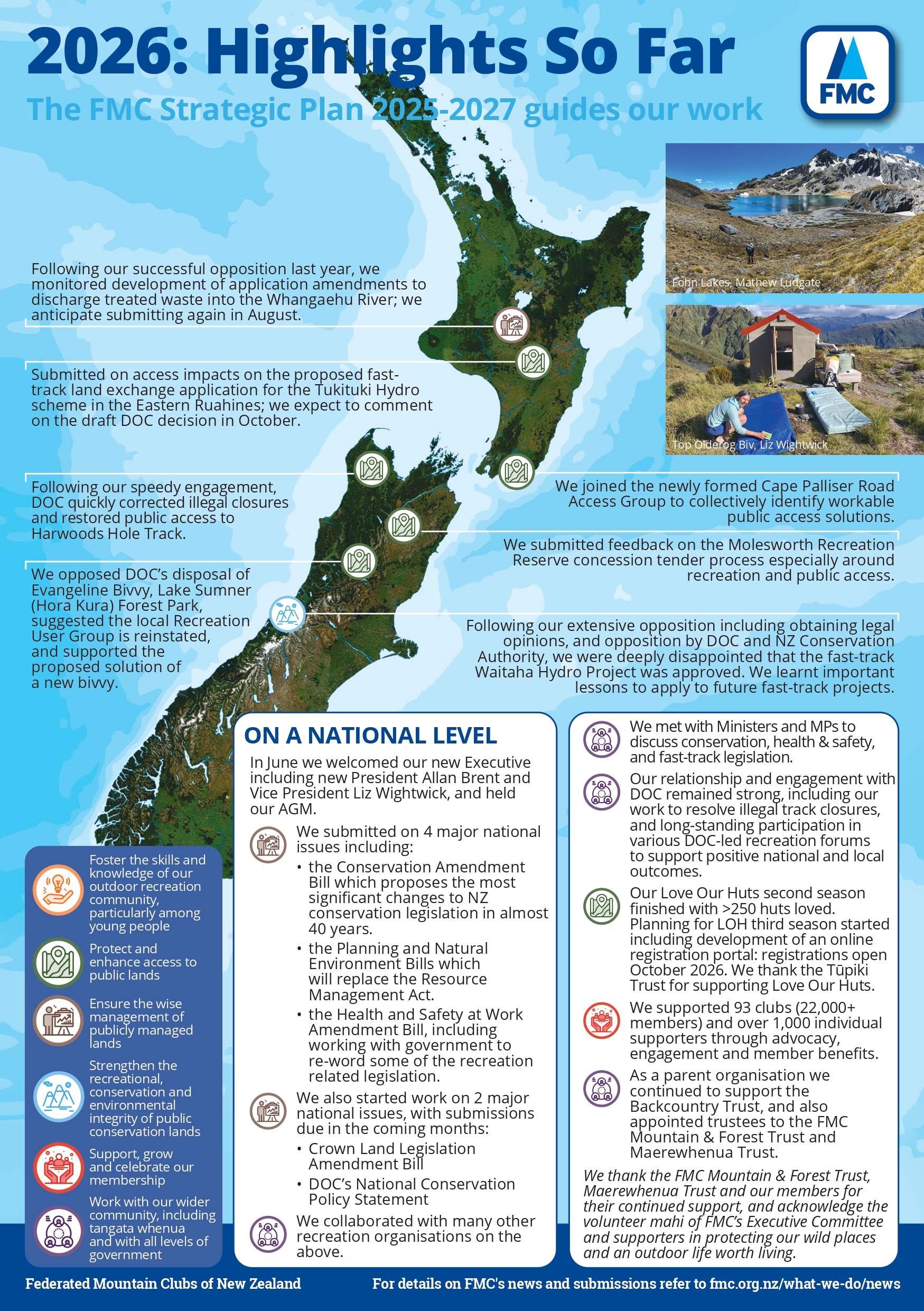
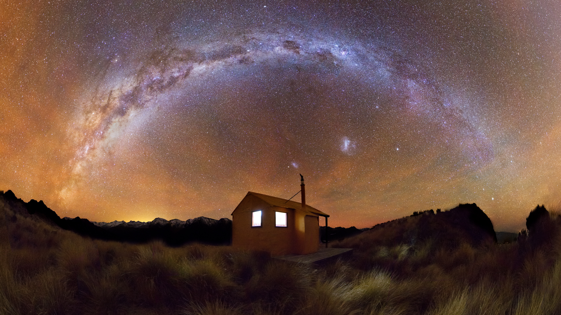
We’re already more than halfway through 2026, and FMC has been hard at work representing the voices of 23,000 outdoor recreation enthusiasts across New Zealand.
FMC has lodged its submission on the Conservation Amendment Bill, with detailed comments and recommendations on nine key issues.

