FMC launches stewardship land map

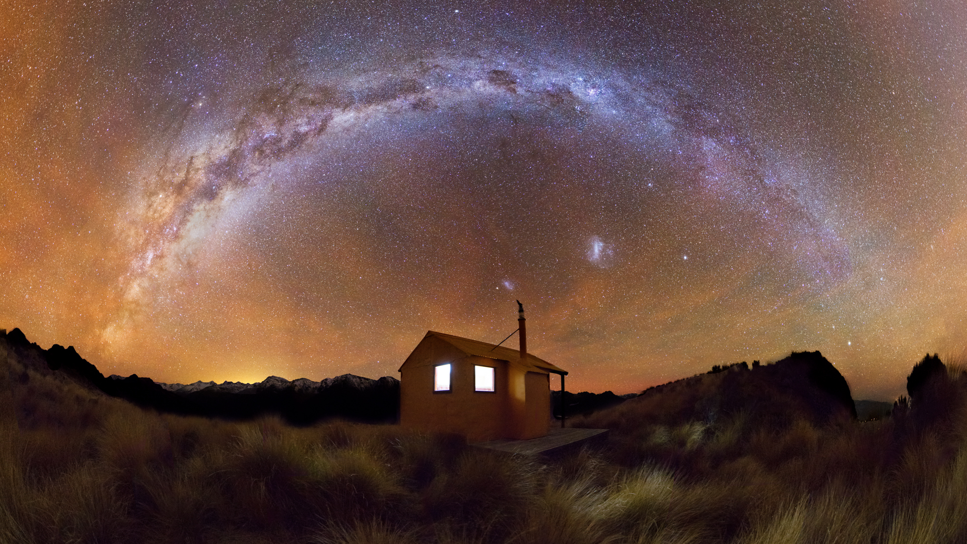
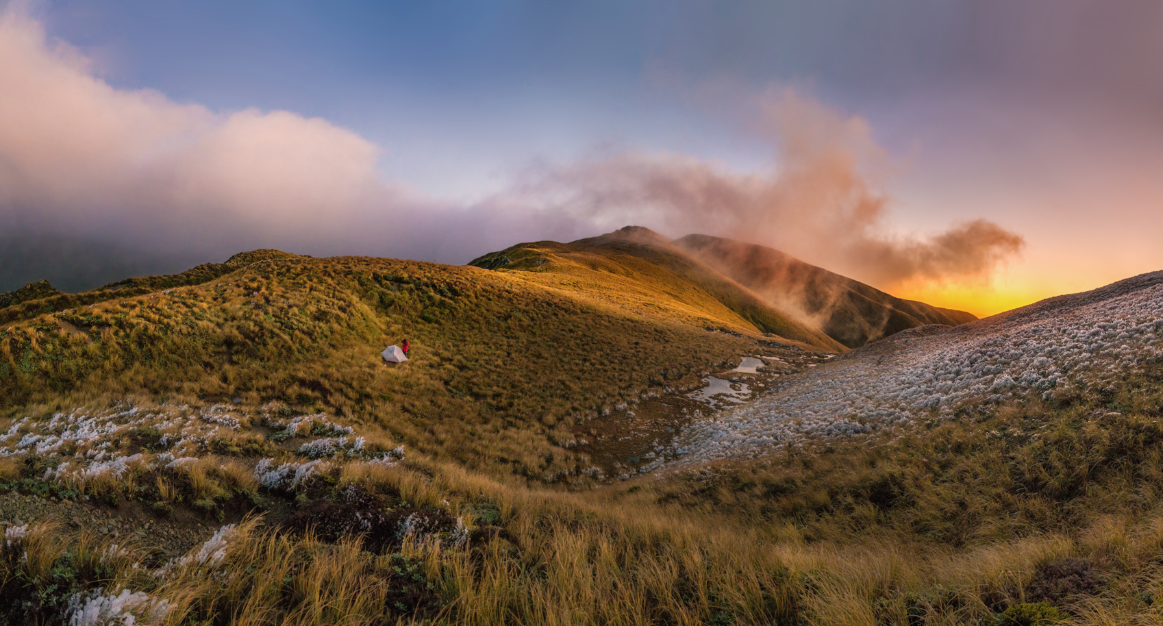
Stewardship land is public conservation land, mostly with high values, but without the classifications to match those values. It includes the Remarkables, the Waitaha, the Adams Wilderness Area, and many other unique areas. Now, with grand-scale reclassification about to begin, FMC has produced a map that shows you exactly where the land parcels are, as well as additional information for each area.
The stewardship land category, subject of FMC’s Forgotten Lands campaign, has been described as a ‘statutory holding pen’. Containing around 30% of public conservation land and 9% of New Zealand, it was established along with the Department of Conservation in 1987, with the intent of giving the land parcels bespoke classification such as national park or scenic reserve.
That reclassification largely didn’t happen, and in 2014, FMC launched Forgotten Lands in response to the Parliamentary Commissioner for the Environment’s report Investigating the future of conservation: the case of stewardship land. The campaign was designed to amplify the issue and push for the long-promised reclassification of stewardship land, which, with its values largely unrecognised, is vulnerable to commercial interests.
In 2021, FMC welcomed the start of a project to reclassify all stewardship land and recently submitted on proposals to fast-track the statutory process. We invite you to take a tour around the stewardship estate and see for yourself what’s included – and what’s at stake.
Share This Story, Choose Your Platform!

Latest News
Submit on the National Conservation Policy Statement, which will shape how our public conservation land is managed for years to come.
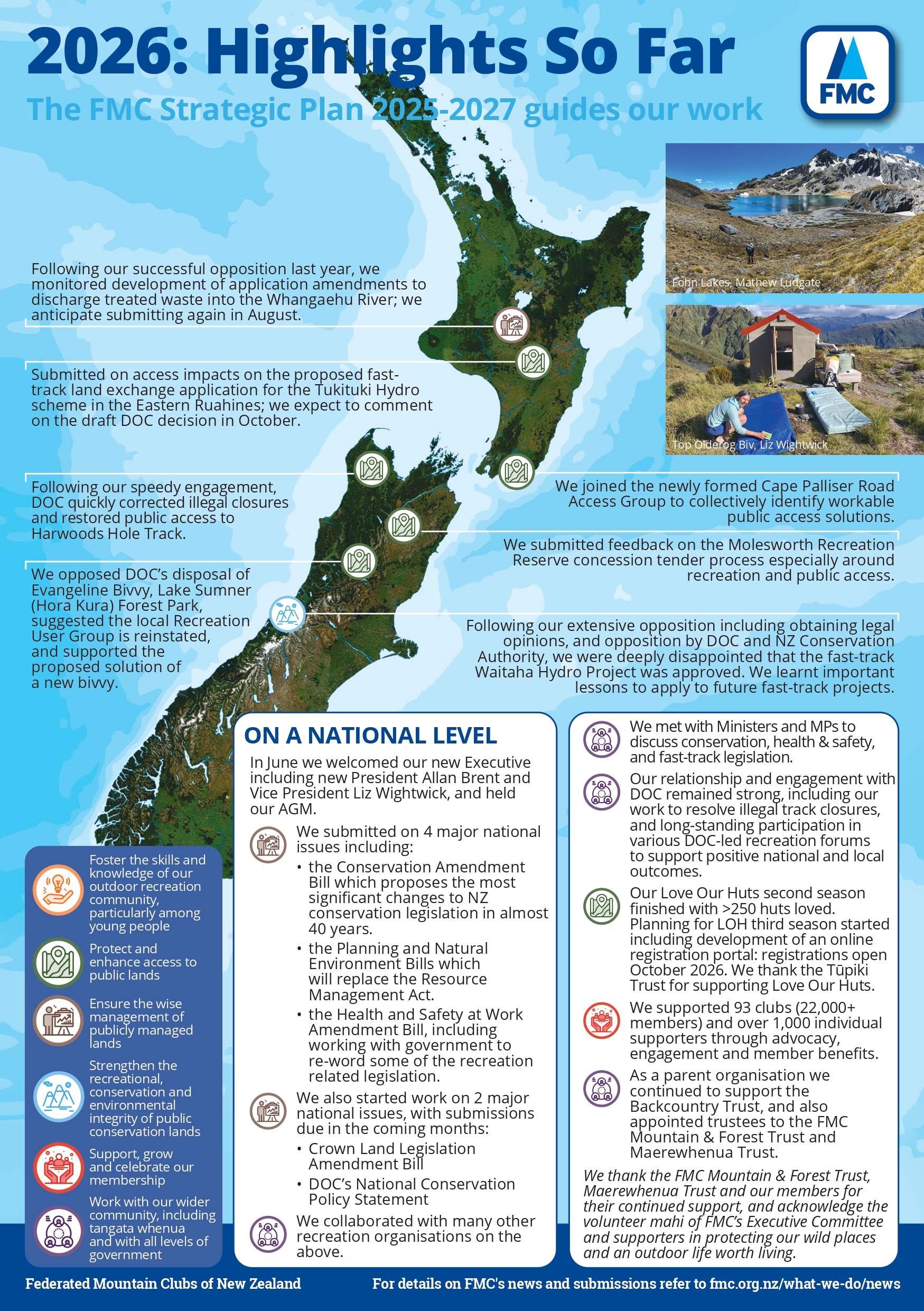
We’re already more than halfway through 2026, and FMC has been hard at work representing the voices of 23,000 outdoor recreation enthusiasts across New Zealand.
FMC has lodged its submission on the Conservation Amendment Bill, with detailed comments and recommendations on nine key issues.

